




Local off-road trail systems differ because of three overlapping forces: physical site limits (soils, slope, and hydrology), management rules and land ownership, and the cumulative impact of vehicles and riders. Understanding why local trail systems vary is the difference between a great ride and a stuck machine, a fine, or a permanently closed trail.
Here’s what those forces look like on the ground:
- Steep, rocky terrain produces narrow, technical trails with tight switchbacks and exposed roots.
- Flat, poorly drained soils often require gravel, geotextile, or concrete tread hardening just to stay rideable.
- Patchwork ownership means a trail can cross three land managers in five miles, each with different rules and permitted vehicles.
- Heavy use without maintenance turns a rated trail into a braided, rutted mess that no difficulty label accurately describes.
Two things to do right now: confirm the trail is open and legally accessible for your vehicle type, then check whether it rained in the last 48 hours. Those two checks alone prevent most bad days.
Key Takeaways
Local trail systems vary because physical site conditions, management decisions, and rider behavior each shape the tread, rules, and difficulty of every trail you ride.
| Point | Details |
|---|---|
| Physical site limits drive design | Slope, soil type, and hydrology determine trail construction, drainage needs, and long-term durability. |
| Ownership changes the rules | Public land, private easements, and agency priorities each produce different access rules, closures, and permitted vehicles. |
| Difficulty ratings are not permanent | The Forest Service bases ratings on grade, alignment, clearing width, and tread condition — all of which change with erosion and use. |
| Vehicle and rider choices accelerate wear | Machine weight, tire selection, and off-route travel are the primary causes of braiding, rutting, and tread failure. |
| Stewardship protects your access | Staying on designated tread, avoiding wet trails, and joining maintenance days keeps trails open for every rider. |
Table of Contents
- Your pre-ride checklist before you leave the driveway
- How physical site factors shape trail character
- How ownership and agency rules shape what you can ride
- What trail design and maintenance actually determine
- How your vehicle and riding style change the trail
- Environmental sensitivity and local politics close trails
- How to pick the right trail and protect your access
- Ready to ride? Find the right machine for your trails
- Authoritative resources for trail status and planning
- A note from Mario on why this matters to every rider
- Key Takeaways
- Authoritative resources for trail status and planning
- A note from Mario on why this matters to every rider
- Sources
Your pre-ride checklist before you leave the driveway
- Confirm trail status and access. Look up the managing agency’s current motor vehicle use map or OHV designation page. Access is often a patchwork of public land and private easements that landowners can revoke over liability or nuisance concerns, sometimes between seasons.
- Check recent weather. Rain in the last 48 hours, or a recent freeze/thaw cycle, can transform a moderate trail into a soupy trench. Review weather riding safety guidance before heading out in uncertain conditions.
- Match your vehicle to the trail width and class. A full-size UTV at 64 inches wide needs a different trail than a 50-inch ATV or a dirt bike. Confirm the trail’s design width and weight limits before you load up.
- Check tire choice and ground clearance. Paddle tires chew soft soils; knobby all-terrain tires suit most hardpack. Read up on tire selection and performance to match rubber to the terrain you expect.
- Pack minimum safety gear. Helmet, eye protection, gloves, and a charged phone or GPS device. Know where the nearest trailhead parking and turnaround points are.
Pro Tip: Call the local land manager or OHV club the day before a long trip. Rangers and club volunteers often know about washouts, downed trees, or temporary closures that haven’t hit the agency website yet.
How physical site factors shape trail character
Topography is the first filter. Slope determines how fast water moves across a trail surface, and fast-moving water erodes tread. The Forest Service trail development guidance defines difficulty ratings using grade, alignment, clearing width, and tread condition — and notes those ratings shift as erosion and use accumulate. A trail rated “moderate” in spring can ride like an advanced trail by late summer if drainage fails.
Soil type is equally decisive. Sandy soils drain fast but displace under tire pressure. Clay holds water and becomes slick. Peat and muck compress under machine weight, creating permanent ruts that widen with every pass. USFS soil and trail suitability research confirms that bearing strength and cohesion determine how quickly a tread surface fails, which explains why some sites require expensive construction or are avoided entirely.
Hydrology drives the biggest maintenance costs. Flat terrain with poor drainage collects water on the tread surface, accelerating rutting and braiding. Managers address this with crowned tread, side ditches, and culverts. Where those fixes aren’t enough, sustainable trail design guidelines call for tread hardening with rock, gravel, or geotextile fabric. Few existing OHV trails meet all design guidelines, which is why so many feel inconsistent from one county to the next.
Climate adds a seasonal layer. Freeze/thaw cycles in northern states heave and crack hardened surfaces. Wet seasons in the Southeast turn clay-based trails into obstacles. The USDA ERS ruggedness scale research illustrates how the distribution of steep or broken terrain across the U.S. explains regional differences in trail style and availability — riders in the Appalachians face fundamentally different terrain than those in the Great Plains.
Common outcomes when physical factors go unmanaged:
- Entrenched tread from repeated water channeling down the trail centerline
- Braided sections where riders detour around wet spots, widening the impact zone
- Pooled water at low points with no outlet drainage
- Exposed roots and rock as soil erodes from around them
How ownership and agency rules shape what you can ride
Land ownership is the most underappreciated reason trail systems differ. Public lands managed by the U.S. Forest Service, Bureau of Land Management, or state DNRs each carry distinct OHV regulations, permit requirements, and seasonal closures. Private easements add another layer: a trail that was open last fall may be closed this spring because a landowner withdrew permission.
The Minnesota ATV Strategic Master Plan uses spatial analysis to identify suitable trail opportunity areas and explicitly exclude lands with ownership conflicts, ecological sensitivity, or poor soil suitability — demonstrating that where a trail can legally and sustainably go is often more constrained than riders expect.
Agency priorities shape trail character directly. A state DNR focused on ecological protection will route trails away from wetlands and require seasonal closures during nesting seasons. A recreation-focused county program may prioritize connectivity and loop length. Funding gaps between agencies explain why one trail system gets annual grading while a neighboring one stays primitive for years.
Volunteer clubs and local governments fill critical gaps. Many of the best-maintained OHV systems in the Midwest and Southeast exist because local clubs contribute labor and secure grant funding. The Wisconsin DNR ATV and UTV trail guidelines frame trail development explicitly around managing environmental and social impacts, with vehicle differences — especially UTV width and weight — called out as growing design and maintenance concerns.
Key access variables to check before every ride:
- Current motor vehicle use map or designated route list
- Permit or registration requirements for your state and vehicle class
- Active seasonal closures (wet-season, wildlife, or fire-related)
- Whether the trail crosses private land and whether that access is current
What trail design and maintenance actually determine
Sustainable trail design is built around one principle: keep water off the tread. Contour alignment routes a trail across a slope rather than straight up it, so gravity carries water off the side instead of down the middle. Grade reversals create natural drainage breaks. Benching cuts a level platform into a hillside to prevent the tread from sliding downslope. These elements, detailed in USDA Forest Service sustainable design guidance, are standard on well-built trails but absent on older or underfunded systems.
Trail width and turn radius specs differ by vehicle class. Dirt bike trails are typically narrower with tighter turns. ATV trails are wider with gentler curves. UTV trails require the most width, the most robust bridges, and the most aggressive drainage because of greater machine weight and footprint. Managers who built their systems for ATVs in the 1990s often find those trails inadequate for today’s side-by-sides.
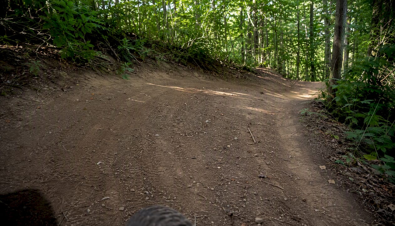
Maintenance frequency depends on use levels, funding, and volunteer capacity. A heavily used trail near a population center may need grading twice a season. A remote primitive trail may go years between interventions. That gap is why two trails with the same difficulty rating can feel completely different.
Pro Tip: A recently maintained trail shows fresh blade marks on the tread surface, clear drainage ditches, and cut brush along the edges. An unmanaged section shows encroaching vegetation, standing water, and deep ruts with no drainage outlet. Trust the visual cues more than the posted rating.
How your vehicle and riding style change the trail
Vehicle weight and width are the primary mechanical variables. A lightweight dirt bike distributes load across a narrow contact patch and rarely causes the soil displacement that a 1,500-pound UTV does. UTIA Tennessee OHV trail management research confirms that trails built for dirt bikes are narrower with tighter turns and different drainage geometry than UTV-rated trails. Riding a heavy machine on a bike-rated trail accelerates tread failure.
Rider behavior compounds vehicle impact. Off-route travel to avoid a muddy section is the single fastest way to create a braided trail. Riding at high speed through soft soil displaces more material than slow, deliberate travel. Group riding amplifies everything: ten machines through a wet section cause more damage than one machine through the same section ten times.
Tire choice matters more than most riders realize. Aggressive paddle tires designed for sand dunes chew up clay-based forest trails. Worn tires spin and dig rather than float. Understanding off-road capability and matching it to actual trail conditions is a skill that protects both your machine and the tread surface.
Difficulty ratings assume dry conditions and a typical vehicle for that trail class. Adjust your expectations for:
- Recent rain or standing water
- A heavier or wider machine than the trail was designed for
- Reduced visibility from dust, fog, or low sun angle
- Rider fatigue on long or technical routes
Environmental sensitivity and local politics close trails
Ecological constraints are often invisible until a trail is already built in the wrong place. Wetlands, rare soil types, and wildlife habitat corridors require either avoidance or expensive hardening. GIS-based trail planning research shows planners can model tradeoffs among slope, water bodies, ownership, and scenic preference to find routes that balance rider access with resource protection. When that analysis isn’t done upfront, the result is a trail that either damages sensitive habitat or gets closed after the fact.
User conflicts accelerate closures. Noise complaints from adjacent landowners, safety concerns from hikers sharing a trail, and community opposition to motorized recreation all translate into political pressure on managers. The result is often a restriction, a reroute, or a concentrated riding area that replaces dispersed access.
University of Maine research on landowner incentives and ATV access found that clear communication, technical support, and economic incentives encourage private landowners to maintain access agreements — but that a single enforcement failure or liability incident can end a voluntary arrangement permanently.
Liability is the quiet driver behind many closures. A landowner who allows access assumes risk. Without a formal easement or state liability protection, one injury claim can end access for an entire community of riders.
How to pick the right trail and protect your access
Match your machine and skill to the trail before you leave, not after you’re stuck.
- Check the trail class and design vehicle. Confirm the trail was built for your machine’s width and weight.
- Assess current conditions. Recent rain, freeze/thaw, or reported damage changes the effective difficulty.
- Confirm permission and facilities. Verify the trailhead is open, parking is legal, and your vehicle registration is current.
- Know your red flags. Deep ruts, braided sections, standing water, missing signage, and recent wet weather are all reasons to turn around or choose a different trail.
On-trail stewardship is straightforward: stay on designated tread, never ride a wet trail that’s showing fresh damage, clean your gear and undercarriage to prevent invasive species spread, and report damage to the managing agency. Trail riding etiquette covers the specific behaviors that keep trails open for everyone.
Pro Tip: Joining a single trail maintenance day does more for long-term access than a year of social media posts. Local clubs and state OHV programs regularly post volunteer opportunities. One afternoon with a Pulaski and a McLeod tool earns you goodwill with the land manager and keeps the trail you love on the maintenance schedule.
Ready to ride? Find the right machine for your trails

Knowing your trail is only half the equation. The machine you ride shapes every experience, from how a trail feels underfoot to how much damage you leave behind. At Gokartsusa, we carry vehicles matched to real trail conditions across the country. The Mini Sport Kids ATV with 110cc engine and parental remote start is built for younger riders on beginner-rated trails, with a lightweight frame that’s gentle on tread. The Sport Kart off-road go-kart gives families a trail-capable machine with a 2.5hp 4-stroke engine designed for ages 8 and up. For riders stepping into two wheels, the Demon Kids Gas Dirt Bike runs a 40cc 4-stroke engine with automatic transmission, sized for the narrower trails that beginner riders typically start on. Free shipping, financing options, and a team that rides — that’s the Gokartsusa commitment.
Authoritative resources for trail status and planning
Checking these sources before a ride gives you current, reliable information on access, conditions, and rules:
- USFS Motor Vehicle Use Maps: Available through each national forest’s website; shows designated motorized routes by vehicle class and season.
- State DNR OHV program pages: Minnesota, Wisconsin, Tennessee, and most other states publish current trail status, permit requirements, and seasonal closure notices.
- NOHVCC and Great Trails resources: The NOHVCC OHV planning guide covers trail system design principles, loop variety, and how managers balance rider needs with resource protection.
- Local OHV clubs: Club websites and Facebook groups often carry real-time condition reports faster than agency pages update.
- GIS trail planning outputs: Some state agencies publish spatial data on trail opportunity areas and exclusion zones; useful for understanding why a trail ends where it does.
When in doubt, call the ranger district or land manager directly. A two-minute phone call beats a two-hour drive to a closed gate.
A note from Mario on why this matters to every rider
The riders who understand why trails are built and managed the way they are tend to be the ones who still have trails to ride ten years from now. That’s not a coincidence.
We’ve watched trail systems shrink across the country, not because of bad terrain or bad weather, but because of preventable damage and broken trust between riders and land managers. A single season of riding wet trails or cutting new lines through sensitive soil can undo years of volunteer work and agency goodwill. The physical factors, the ownership rules, the design choices — they all exist because someone fought hard to create and protect that access.
At Gokartsusa, we believe the best riders are the ones who match their machine to the trail, check conditions before they ride, and give back to the systems they use. Pick the right vehicle, do your homework, and show up for a maintenance day once in a while. The trail will be there next season because you were.
Key Takeaways
Local trail systems vary because physical site conditions, management decisions, and rider behavior each shape the tread, rules, and difficulty of every trail you ride.
Sources
- UTIA Tennessee — OHV trail management and rider behavior (PB1933)
- A GIS-based method for recreational trail location for ATVs (USFS research)